
MEGALITHS > HUNEBED ATLAS > D37

DRENTHE HUNEBED MAP

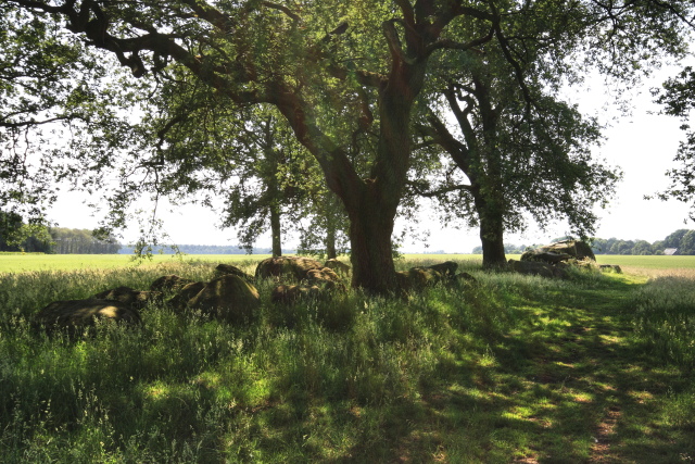
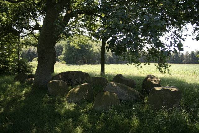
D37 Valthe
Type: Gallery grave
Size: 11.4 x 3.7 m
Town: Valthe
Location: Ooster Esch
Latitude N: 52.839788
Longitude E: 6.894654
Orientation: 80° (90° = E-W)
First reported 1788 Hottingerkaart (H.J. Versfelt, De Hottinger-atlas van Noord- en Oost-Nederland. 1773-1794)
More crooked and scattered than its twin D36, D37 still has three of its capstones. The two sit in a grove of oak trees in the fields just outside Valthe.
Same group: D36
 Hunebed Map: Photos, info, location maps
About the Megaliths: The Neolithic heritage
Megalith Slideshows: Old stones of Europe
D37 Valthe
Type: Gallery grave
Size: 11.4 x 3.7 m
Town: Valthe
Location: Ooster Esch
Latitude N: 52.839788
Longitude E: 6.894654
Orientation: 80° (90° = E-W)
First reported 1788 Hottingerkaart (H.J. Versfelt, De Hottinger-atlas van Noord- en Oost-Nederland. 1773-1794)
More crooked and scattered than its twin D36, D37 still has three of its capstones. The two sit in a grove of oak trees in the fields just outside Valthe.
Same group: D36