
MEGALITHS > HUNEBED ATLAS > D43
DRENTHE HUNEBED MAP

D43 Emmen
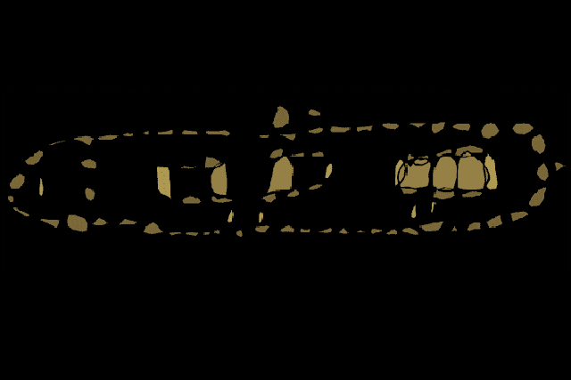
Type: Long barrow with two passage graves
Size: 40.3 x 6.8 m
Town: Emmen
Location: Schimmeres
Latitude N: 52.793238
Longitude E: 6.88705
Orientation: 165° (90° = E-W)
Folk-name: Schimmeres
First reported 1788 Hottingerkaart (H.J. Versfelt, De Hottinger-atlas van Noord- en Oost-Nederland. 1773-1794)
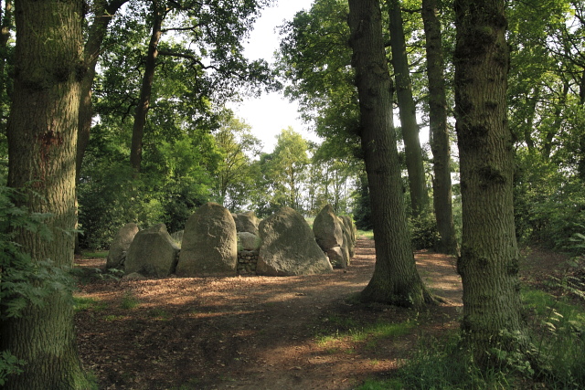
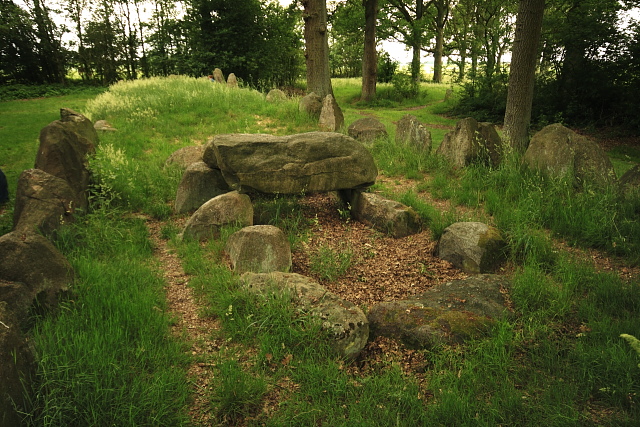
Unique in the Netherlands, although of a type also seen in the north-west German Hummling/Emsland region, D43 is a 'long grave,' a large kerbstone enclosure containing two passage graves inside. It was built in two separate phases as the stone ring was gradually expanded, along with an 'offering pit' added in a third phase. Two more of the pits were found just outside, and the monument was still used in the Bronze Age. Although the two hunebedden are in a ruined state, it offers a good impression of the original monument, protected by a grove of trees that open to the surrounding fields.
 Hunebed Map: Photos, info, location maps
About the Megaliths: The Neolithic heritage
Megalith Slideshows: Old stones of Europe
D43 Emmen
Type: Long barrow with two passage graves
Size: 40.3 x 6.8 m
Town: Emmen
Location: Schimmeres
Latitude N: 52.793238
Longitude E: 6.88705
Orientation: 165° (90° = E-W)
Folk-name: Schimmeres
First reported 1788 Hottingerkaart (H.J. Versfelt, De Hottinger-atlas van Noord- en Oost-Nederland. 1773-1794)
Unique in the Netherlands, although of a type also seen in the north-west German Hummling/Emsland region, D43 is a 'long grave,' a large kerbstone enclosure containing two passage graves inside. It was built in two separate phases as the stone ring was gradually expanded, along with an 'offering pit' added in a third phase. Two more of the pits were found just outside, and the monument was still used in the Bronze Age. Although the two hunebedden are in a ruined state, it offers a good impression of the original monument, protected by a grove of trees that open to the surrounding fields.