
MEGALITHS > HUNEBED ATLAS > D38
DRENTHE HUNEBED MAP

D38 Emmen
Type: Gallery grave?
Size: 8 x 3 m
Town: Emmen
Location: Valtherbos
Latitude N: 52.81133
Longitude E: 6.88754
Orientation: 136° (90° = E-W)
First reported 1788 Hottingerkaart (H.J. Versfelt, De Hottinger-atlas van Noord- en Oost-Nederland. 1773-1794)
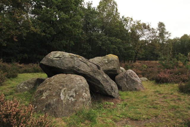
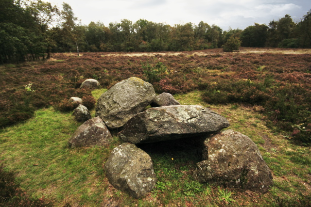
Only two capstones and the skeletal form of the rest of the monument remain of the hunebed D38, which forms a triangle with D39 and 40 in a heather field surrounded by forest in the Valtherbos north of Emmen.
Same group: D39 | D40
 Hunebed Map: Photos, info, location maps
About the Megaliths: The Neolithic heritage
Megalith Slideshows: Old stones of Europe
D38 Emmen
Type: Gallery grave?
Size: 8 x 3 m
Town: Emmen
Location: Valtherbos
Latitude N: 52.81133
Longitude E: 6.88754
Orientation: 136° (90° = E-W)
First reported 1788 Hottingerkaart (H.J. Versfelt, De Hottinger-atlas van Noord- en Oost-Nederland. 1773-1794)
Only two capstones and the skeletal form of the rest of the monument remain of the hunebed D38, which forms a triangle with D39 and 40 in a heather field surrounded by forest in the Valtherbos north of Emmen.
Same group: D39 | D40