
MEGALITHS > HUNEBED ATLAS > D34

DRENTHE HUNEBED MAP

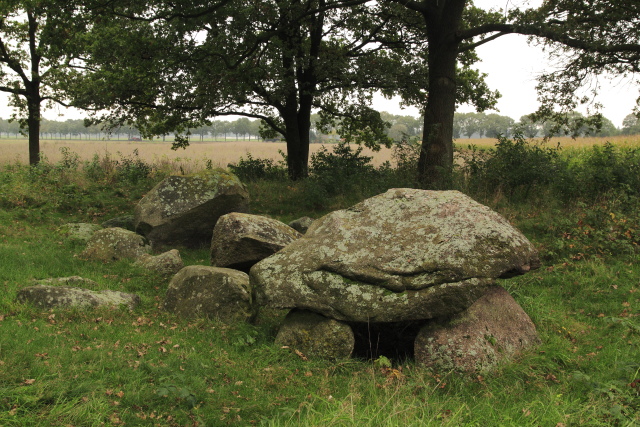
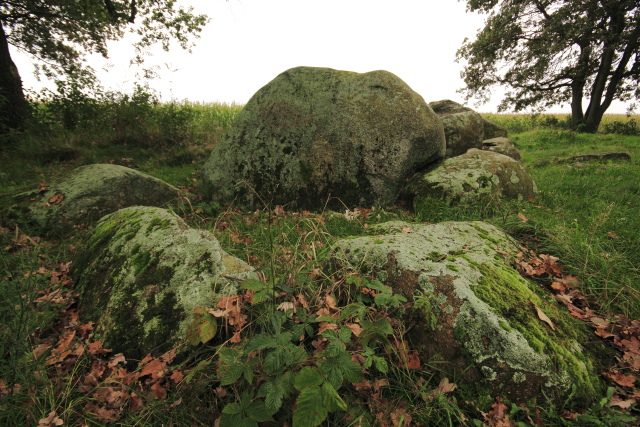
D34 Valthe
Type: Gallery grave
Size: 7.8 x 3 m
Town: Valthe
Location: Oosterveld
Latitude N: 52.842643
Longitude E: 6.867342
Orientation: 42° (90° = E-W)
First reported 1818 R. Boelken in Nieuwe Drentsche Volksalmanak (1887)
D34 is on wooded land at the edge of the fields between Valthe and Odoorn. Its ruined, wild state doesn't undermine its authority in the landscape. It had a near-twin until 1955, when the stones of D33 - now completely vanished - were carried off for the restoration of D49 (the Papeloze Kerk) in Schoonoord.
 Hunebed Map: Photos, info, location maps
About the Megaliths: The Neolithic heritage
Megalith Slideshows: Old stones of Europe
D34 Valthe
Type: Gallery grave
Size: 7.8 x 3 m
Town: Valthe
Location: Oosterveld
Latitude N: 52.842643
Longitude E: 6.867342
Orientation: 42° (90° = E-W)
First reported 1818 R. Boelken in Nieuwe Drentsche Volksalmanak (1887)
D34 is on wooded land at the edge of the fields between Valthe and Odoorn. Its ruined, wild state doesn't undermine its authority in the landscape. It had a near-twin until 1955, when the stones of D33 - now completely vanished - were carried off for the restoration of D49 (the Papeloze Kerk) in Schoonoord.