
MEGALITHS > HUNEBED ATLAS > D15
D15 Loon | Click thumbnails below to view enlarged images | << Back to Hunebed Map


- Photo 1
- Photo 2
- Ground Plan
- Location Map
DRENTHE HUNEBED MAP

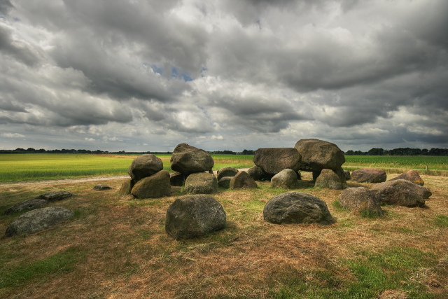
D15 Loon
Type: Passage grave with kerbstone enclosure
Size: 9.6 x 3.6 m
Town: Loon
Location: Looner es
Latitude N: 53.022773
Longitude E: 6.613105
Orientation: 69° (90° = E-W)
First reported 1654 A. van Slichtenhorst
D15 is one of the more complete hunebedden, with a mostly intact ring and entrance portal, and commands a vista of open fields outside the small village of Loon. Little is known of the site's pre-neolithic history, but many finds here from the Bellbeaker culture, the Bronze age and even into the 6th century AD indicate the site was in use for a long time afterward it was built in the neolithic. The well-formed oval ring is made up of relatively large stones, and it still had most of its earthen covering in 1870 when it was excavated.
 Hunebed Map: Photos, info, location maps
About the Megaliths: The Neolithic heritage
Megalith Slideshows: Old stones of Europe
D15 Loon
Type: Passage grave with kerbstone enclosure
Size: 9.6 x 3.6 m
Town: Loon
Location: Looner es
Latitude N: 53.022773
Longitude E: 6.613105
Orientation: 69° (90° = E-W)
First reported 1654 A. van Slichtenhorst
D15 is one of the more complete hunebedden, with a mostly intact ring and entrance portal, and commands a vista of open fields outside the small village of Loon. Little is known of the site's pre-neolithic history, but many finds here from the Bellbeaker culture, the Bronze age and even into the 6th century AD indicate the site was in use for a long time afterward it was built in the neolithic. The well-formed oval ring is made up of relatively large stones, and it still had most of its earthen covering in 1870 when it was excavated.