
MEGALITHS > HUNEBED ATLAS > D7
D7 Schipborg | Click images to enlarge | << Back to Hunebed Map

- Photo 1
- Photo 2
- Ground Plan
- Location Map
DRENTHE HUNEBED MAP

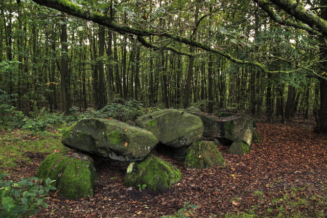
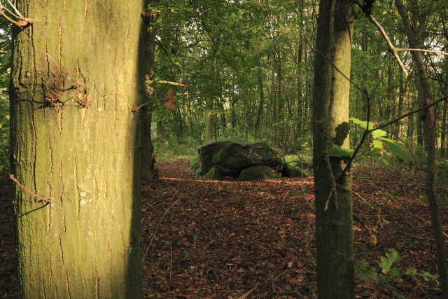
D7 Schipborg
Type: Gallery grave
Size: 8.8 x 3.1 m
Town: Schipborg
Location: Kniphorstbos
Latitude N: 53.061177
Longitude E: 6.684534
Orientation: 97° (90° = E-W)
Folk-name: Holbergien
First reported 1811-1815 N. Westendorp Over de Hunebedden in Letter- en Oudheidkundige Verhandelingen
D7 sits on a rise at the edge of the bush bordering the heath between Annen and Schipborg. There are numerous grafheuvels (burial mounds) in the immediate area, as well as remains of settlements. It is along an ancient system of trackways. Its folk-name, Holbergien, refers to the hollow it occupies in the rise of land.
 Hunebed Map: Photos, info, location maps
About the Megaliths: The Neolithic heritage
Megalith Slideshows: Old stones of Europe
D7 Schipborg
Type: Gallery grave
Size: 8.8 x 3.1 m
Town: Schipborg
Location: Kniphorstbos
Latitude N: 53.061177
Longitude E: 6.684534
Orientation: 97° (90° = E-W)
Folk-name: Holbergien
First reported 1811-1815 N. Westendorp Over de Hunebedden in Letter- en Oudheidkundige Verhandelingen
D7 sits on a rise at the edge of the bush bordering the heath between Annen and Schipborg. There are numerous grafheuvels (burial mounds) in the immediate area, as well as remains of settlements. It is along an ancient system of trackways. Its folk-name, Holbergien, refers to the hollow it occupies in the rise of land.