
MEGALITHS > HUNEBED ATLAS > D3

DRENTHE HUNEBED MAP

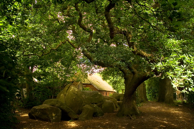
D3 Midlaren
Type: Gallery grave
Size: 10.7 x 4.4 m
Town: Midlaren
Location: Steenakkers
Latitude N: 53.107827
Longitude E: 6.671414
Orientation: 86° (90° = E-W)
Folk-name: De Hunenborg (with D4)
First reported 1711 Ludolph Smids Schatkamer der Nederlandsse Oudheiden
D3 and its twin D4 form a long line of stones, well-aligned to E-W, that nestle beside a picturesquely ruined farmhouse on the edge of the village of Midlaren. They are in a rather rough state, but recent restorations have led to discoveries of Funnelbeaker pottery on the terrain.
Same group: D4
 Hunebed Map: Photos, info, location maps
About the Megaliths: The Neolithic heritage
Megalith Slideshows: Old stones of Europe
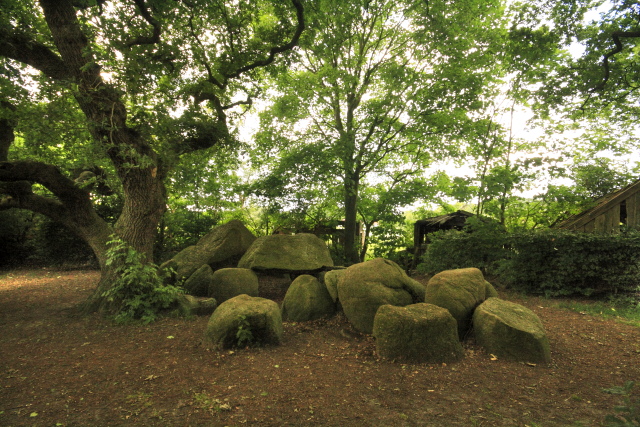
D3 Midlaren
Type: Gallery grave
Size: 10.7 x 4.4 m
Town: Midlaren
Location: Steenakkers
Latitude N: 53.107827
Longitude E: 6.671414
Orientation: 86° (90° = E-W)
Folk-name: De Hunenborg (with D4)
First reported 1711 Ludolph Smids Schatkamer der Nederlandsse Oudheiden
D3 and its twin D4 form a long line of stones, well-aligned to E-W, that nestle beside a picturesquely ruined farmhouse on the edge of the village of Midlaren. They are in a rather rough state, but recent restorations have led to discoveries of Funnelbeaker pottery on the terrain.
Same group: D4